Dynamic ocean topography (DOT) seems fairly observed, understood, and modeled. There are several satellites observing DOT in real time (OSTM/Jason-2 and Jason 3). There are numerous models (see several listed in the introductory post) for understanding long term trends and near real time DOT. So what does this leave for improvement and future work?
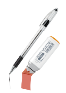
One of the more exciting developments in current research is the upcoming launch of the Surface Water and Ocean Topography (SWOT) satellite mission scheduled for 2021. It will offer unprecedented long term, high resolution monitoring. SWOT will be like an extra wide marker versus a fine tip pen when compared to current satellite missions’ data coverage. Such dense data will allow for much higher resolution modeling and monitoring, which has the potential to lead to new discoveries and a deeper understanding of various environmental processes.
But SWOT hasn’t even launched yet. Current work around the SWOT mission is largely planning and outreach to ensure people will be ready to use the data when it starts to become available in 2021. To that end the SWOT team has been conducting workshops with potential users. The latest workshop, held April 2017, was covered in Earth & Space Science News, Putting Satellite Maps of Surface Water to Practical Use which discussed the broad topics and participants. A more in depth summary of the meeting was more recently published in the Bulletin of the American Meteorological Society (BAMS), Engaging the User Community for Advancing Societal Applications of the Surface Water Ocean Topography Mission.
In the BAMS meeting summary author Faisal Hossain highlighted the key interests of participating organisations. For organizations like the U.S. Geological Survey, U.S. Bureau of Reclamation, U.S. Army Corps of Engineers, and Indian Institutes of Technology (India) Hossain noted their strong interest in water management of lakes and rivers and the improvements SWOT could bring to modeling and monitoring the associated watersheds. For Mercator Ocean (France), Collecte Localisation Satellites (France, part of CNES), ARDIAN, and IFREMER, Hossain highlighted their expectation of “improved constraint of ocean models at about 20-km scale as opposed to the current state of the art afforded by altimeters at scales of hundreds of kilometers.”
Hossain closed out the meeting summary with findings from the workshop. The first finding was the applications that users anticipated would be enabled by the SWOT missions, which he listed as
1) disaster response and management,
2) water resources management, and
3) ocean and estuarine applications.
Additional findings were a strong demand for near real time data products, “latency of less than 2 days,” to enable many of the applications, and a need for further education and training of the user community prior to the mission launch. And in closing Hossain revisited the findings, highlighting the desire for low latency in the data products and the need for further community outreach.
SWOT has great potential to fill a significant gap in our understanding of environmental dynamics, part of that being higher resolution DOT observations and modeling. It is exciting to see the team actively participating with and seeking feedback from the future user community.
Other Posts in the Series
- GGE6022 – Advanced Topics in Ocean Mapping
- Dynamic Ocean Topography: An Introduction
- Inverse Barometric Effect: A Contribution to Dynamic Ocean Topography
- A Model of Dynamic Ocean Topography
- What is new in dynamic ocean topography? (this post)
- Dynamic Ocean Topography in a Flat Earth Perspective
- Lesson Plan: Dynamic Ocean Topography